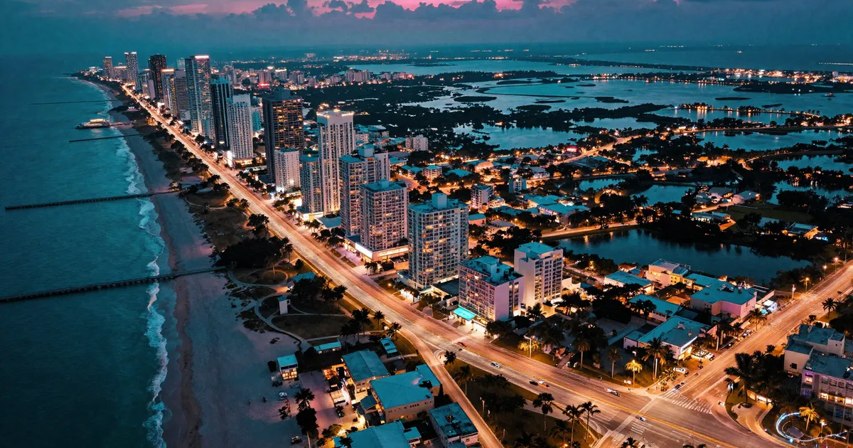
The GTA 6 map is the biggest, most scrutinized open world Rockstar has ever built, and we have not even been handed the actual map yet. Everything we know about the state of Leonida comes from two trailers, a huge official screenshot drop, Rockstar’s own website, and a fan mapping effort that borders on obsessive. This page pulls all of it together: every confirmed region, the real Florida places behind them, how big the world is likely to be compared to GTA 5 and RDR2, and what the water, swamps, and interiors mean for how the game will actually play.
One rule before we start. Anything sourced from official Rockstar material is labeled as confirmed. Anything from the 2022 leak, insider claims, or community reconstruction is labeled as exactly that. The two get blurred together constantly on social media. Not here.
What’s on this page
- Leonida, the state that holds the whole map
- The evidence timeline
- Vice City
- Leonida Keys
- Grassrivers
- Port Gellhorn
- Ambrosia
- Mount Kalaga
- How big is the GTA 6 map?
- How the community mapped Leonida
- Water everywhere: what the geography means for gameplay
- Interiors and enterable buildings
- Leonida vs real Florida
- What we still don’t know
- FAQ
Welcome to Leonida, the state of the GTA 6 map
GTA 6 is set in Leonida, a fictional state modeled on modern Florida. That is official. Rockstar confirmed the name in the first trailer marketing back in December 2023, and the official GTA 6 website fleshed it out in May 2025 alongside the second trailer, with dedicated pages for each region and around 70 official screenshots. Coverage from Game Informer at the time walked through all six revealed areas.
The structure matters. GTA 5 gave us one city, Los Santos, plus a chunk of countryside called Blaine County. Leonida is a whole state with one major city inside it. Vice City anchors the southeast coast, and the rest of the map fans out from there: island chains to the south, wetlands to the southwest, a decaying port town on the Gulf side, sugar farmland inland, and forested high ground in the north. Six named regions, no loading screens between them.
The six officially confirmed regions:
| Region | Rockstar’s framing (paraphrased) | Type |
|---|---|---|
| Vice City | The sun-soaked capital of excess, hustle, and money | Major city |
| Leonida Keys | A laid-back tropical island chain next to dangerous waters | Islands |
| Grassrivers | Untamed wetlands full of gators and stranger things | Swamp |
| Port Gellhorn | A faded Gulf coast town with a criminal economy | Small town |
| Ambrosia | Industrial sugar country and small-town Leonida | Rural |
| Mount Kalaga | A wild national park built for off-road trouble | Forest/highlands |
Beneath the region names sits a county layer that is not official. Community mappers and dataminers, working from road signs and environmental text visible in screenshots and leaked footage, have pieced together county names like Vice-Dale (a clear riff on Miami-Dade), Kelly, Leonard, Mariana, and Ambrosia County, as documented by GTABase’s map hub. Those names are plausible and some appear on in-game signage, but Rockstar has never published a county map. File them as strongly supported but unofficial.
One more thing on the state itself. Fans spotted references to a neighboring state called Gloriana, Rockstar’s apparent Georgia analog, on license plates in official material. That has fueled a running theory about map expansion to the north after launch. It is a theory. Nothing more, for now.
The evidence timeline: how the map got revealed
Because this page constantly separates confirmed from reconstructed, it helps to know exactly where each layer of knowledge came from. Four moments built everything we know about the GTA 6 map.
September 2022: the leak. Around 90 clips of an in-development build hit the internet in the biggest security breach in the industry’s history. The footage was raw and years from final, but it confirmed the Vice City setting early and, critically for mappers, exposed debug coordinates and location names that still anchor community reconstructions today. Details on what surfaced are archived on the GTA Wiki leak page. Everything sourced from this build carries an asterisk. It was old footage when it leaked and it is ancient now.
December 4, 2023: Trailer 1. The official reveal. Leonida and Vice City named, the modern-day setting confirmed, and the first clean look at Ocean Beach, the wetlands, and the state’s social media-saturated tone. Mappers extracted dozens of location anchors from 91 seconds of footage.
May 6, 2025: Trailer 2 and the site update. The motherlode. Alongside the second trailer, Rockstar’s website relaunched with named pages for all six regions, the full character roster, and roughly 70 screenshots. Almost every officially confirmed place name on this page traces to that single day.
November 2025 to now. Rockstar announced the final delay to November 19, 2026, and has been quiet on map specifics since. As of mid-July 2026 the community expects a third trailer on the usual pre-launch cadence, and the working assumption is that it, or the preview cycle around it, finally shows the in-game map screen. Our release date tracker follows that watch daily.
Vice City: the heart of the GTA 6 map
Vice City is back for the first time since the 2002 original and its 2006 prequel, and this time it is a modern Miami, not a 1980s pastiche. Rockstar’s own material presents it as the centerpiece of the map, a city built on glamour and greed in roughly equal measure.
What is officially confirmed, per the Rockstar site and trailer footage:
- Ocean Beach. The postcard district. Art deco hotels in pastel colors, white sand, muscle beach energy, and the crowds to match. This is the South Beach analog and it is all over both trailers. The density of NPCs on the beach in Trailer 2 is unlike anything Rockstar has shown before.
- Little Cuba. Rockstar’s take on Little Havana, with bakeries, street life, and a working-class Cuban-American character that the real Miami neighborhood is famous for.
- The Tisha-Wocka flea market. A bootleg-goods market that suggests Rockstar is modeling Miami’s swap-meet culture, not just its glamour.
- VC Port. A massive cruise and cargo port. Rockstar frames Vice City as the cruise ship capital of the world, which mirrors the real PortMiami. Expect it to matter for missions. Ports always do in GTA.
- Vice City International Airport and a metro system. Both have been spotted in official media, and GTABase has cataloged evidence of a working tram and metro station. Functional public transit in a GTA game would be a genuine first at this fidelity.
Beyond the confirmed districts, community mapping places downtown towers, a stadium, marinas, causeways, and sprawling suburban blocks around the urban core. The city sits inside what mappers call Vice-Dale County, and the layout tracks real Miami closely: barrier island beach strip on the Atlantic side, a bay behind it, causeways crossing to the mainland grid.
On the activity front, official footage points at nightclubs with actual crowds, street racing culture, beachfront life that reacts to you, and the social-feed satire that both trailers weaponize. Add the port, the airport, and a metro, and Vice City has more distinct mission environments than the entire GTA 5 map managed. That claim is mine, but count the venues yourself and see if you disagree.
My opinion, clearly labeled as opinion: Vice City looks like the densest city Rockstar has ever attempted, and the beach crowds alone suggest simulation ambitions beyond anything in GTA 5 or RDR2. Whether that density holds across the whole city at 60 frames per second is a different question, and one nobody outside Rockstar can answer yet.
If you want to know who you will be sharing these streets with, our full GTA 6 character guide covers Jason, Lucia, and everyone Rockstar has introduced. Several of the supporting cast, like the rap duo Real Dimez, are tied directly to Vice City’s music and club scene.
Leonida Keys: the southern island chain
The Leonida Keys are the game’s Florida Keys, a chain of tropical islands strung along the southern edge of the map and linked by long over-water bridges. Rockstar’s framing is that life down here is easygoing and unflashy, but the surrounding waters are some of the most dangerous in America. That is a loaded sentence for a crime game. Smuggling routes practically write themselves.
Confirmed details:
- Key Lento is the named settlement, an obvious nod to Key Largo, and per the GTA Wiki’s compiled evidence it is where protagonist Jason Duval lives at the start of the game, in a stilt house owned by the veteran smuggler Brian Heder.
- Official screenshots show dive bars, marinas, tattoo parlors, and roadside businesses. Community catalogs list spots like a tattoo shop and multiple bars around Key Lento, per GTA6Intel’s location tracker.
- Trailer 2 leans heavily on the Keys: boat runs under bridges, beach shacks, and the general sense that the early game lives down here before the story pulls Jason and Lucia toward the big city.
Geographically, the Keys change how the bottom of the map works. In GTA 5 the southern edge was city; here it is a long, thin archipelago surrounded by open water, reef, and channels. The single highway spine connecting the islands mirrors the real Overseas Highway, and a road like that is a gift for chases. One way in, one way out, water on both sides.
The real Keys sit at the end of a long chain stretching toward Key West. Whether Leonida’s version has a Key West analog at its far end is unconfirmed, though community maps sketch several islands beyond Key Lento. Expect the smallest of them to hide the best secrets. Rockstar has always used map edges for that.
Activity-wise, the Keys look like the map’s playground for everything that floats. Official imagery shows fishing charters, jet skis, diving spots, and beach bars, and the reef-and-wreck waters around the islands are the most obvious home for treasure-hunt content since GTA Online’s sunken caches. Add the bar culture Rockstar keeps emphasizing and I would expect the Keys to carry a disproportionate share of the game’s side content for their size.
Grassrivers: the wetlands
Grassrivers is the Everglades, and the name is sharper than it first looks. The real Everglades’ famous nickname is the river of grass. Rockstar just compounded it.
Officially, Grassrivers is presented as a primordial wetland where the gators are the headline attraction but not the deadliest thing out there. The official site’s region page teases weirder discoveries among the mangroves, which reads like a direct promise of the mystery-hunting content this community lives for. GTA 5’s Mount Chiliad conspiracy kept people digging for a decade. A swamp with intentionally weird things in it feels like Rockstar building that layer in on purpose. That last sentence is speculation, but I would bet on it.
What the footage and screenshots show:
- Airboats moving through sawgrass channels. Airboat traversal is effectively confirmed by official imagery.
- Alligators as ambient wildlife, including the already-famous official screenshot of a gator wandering into a convenience store.
- Stilt shacks, fishing camps, and swamp roads on raised embankments.
- Mangrove coastline where the wetland meets the Gulf.
Community mapping places Grassrivers across the map’s southwest, in what dataminers call Mariana County, wrapping around toward Watson Bay on the coast. That positioning mirrors the real geography, where the Everglades fill most of the peninsula’s southern tip west of Miami.
For gameplay, Grassrivers is the anti-city. No sightlines, no grid, water that ordinary cars cannot cross. If Rockstar wants a place where you dump bodies, hide from wanted levels, and stumble into cult compounds, this is it. RDR2’s Bayou Nwa and Guarma showed the studio can make wetlands feel oppressive and alive. This should be that, at next-gen scale.
Expected activities, based on what official media shows and what the terrain demands: airboat racing and traversal, gator encounters as both hazard and hunting content, fishing camps, and whatever the “weirder discoveries” line turns out to mean. The whole region also reads as natural stealth space. Wanted-level mechanics that interact with dense cover and waterways would make Grassrivers the best escape zone Rockstar has ever built, though that last part is my speculation, not anything shown.
For the full rundown on every gator, dolphin, and other confirmed species across Leonida, plus what Rockstar has said about hunting and fishing at Mount Kalaga, see our complete GTA 6 animals and wildlife guide.
Port Gellhorn: the Gulf coast underbelly
Port Gellhorn is the map’s second settlement and its most interesting one, in my view. It is a run-down port and faded vacation town on the Gulf coast, the kind of place where the boardwalk paint peeled off decades ago and the local economy quietly restructured around vice. Rockstar’s framing describes a town whose glory days ended long ago, now running on hustle and whatever sells, per the region reveals covered by Game Informer.
The real-world inspiration reads as the Florida Panhandle, somewhere in the Panama City Beach family: spring break strips gone to seed, motels by the hour, dive bars, and an industrial port bolted onto the side. Community mappers place it on the northwest coast in Kelly County, far from Vice City, which matters. It gives the opposite corner of the map its own urban gravity so the whole state does not tilt southeast.
Officially revealed and trailer-spotted elements include a strip club, a boxing gym, drag racing culture, motels, and the working port itself. Several announced characters are anchored here, and the story looks likely to route through the town’s criminal food chain. Again, the character guide has the full rundown of who operates where.
Small point that I think is underrated: a decaying port town on the opposite coast means coastal water on two sides of the map with completely different character. Atlantic party coast in the east, industrial Gulf grime in the west. GTA 5 never had that contrast.
Ambrosia: sugar country
Ambrosia is the interior. Rockstar presents it as an industrial-agricultural region dominated by sugar refining, and its tagline frames the region as the place that keeps Leonida sweet. Smokestacks over cane fields, small towns in the shadow of the refinery, and by most readings a strong biker-gang presence, a detail cataloged by GTABase from official media.
The real-world source is unmistakable if you know Florida: the sugar belt south of Lake Okeechobee, towns like Clewiston and Belle Glade, where U.S. Sugar’s mills define the horizon and the economy. Community maps back this up by placing Ambrosia against a huge inland lake, Lake Leonida, which is plainly the Okeechobee analog. An enormous lake in the middle of the map is a big deal on its own. GTA has never had a true inland sea.
Expected texture based on official imagery and mapping work:
- Cane fields and controlled burns, refinery infrastructure, freight rail.
- Two-lane highways, trailer parks, gas stations, roadside diners.
- Biker bars and the slow-burn rural crime that goes with them.
Nothing about Ambrosia is glamorous, which is exactly the point. Every great Rockstar map needs its Sandy Shores, the region where the story goes when things get desperate. Ambrosia looks purpose-built for that role. Opinion, but a confident one.
Mount Kalaga: the wild north
Mount Kalaga is the region that makes Florida purists twitch, because Florida famously has no mountains. Rockstar’s answer is a national park of forested ridges, rivers, and canyons in Leonida’s far north, closer in spirit to north Florida and the Georgia line, where the terrain genuinely does start to roll. Analysis by GTABase points at Providence Canyon in Georgia as a likely visual reference for the exposed orange-red canyon walls seen in official shots.
Rockstar’s framing sells it as wild country: hunting, fishing, off-road trails, and the strong implication that the people living up there prefer not to be found. Officially spotted elements include dirt-bike and off-road trails, dense pine forest, waterfalls, and rafting-friendly rivers.
Mount Kalaga does two jobs on the map. First, it is the terrain-variety valve, giving the state elevation, canyon roads, and forest that the flat peninsula cannot provide, the way Mount Chiliad did for San Andreas. Second, it hard-caps the map’s northern edge with wilderness rather than an awkward ocean cutoff, and if the Gloriana expansion theory ever comes true, this is the border it would cross.
For vehicle players, this is where the off-road classes will earn their keep. Our confirmed GTA 6 cars list tracks every dirt bike, truck, and off-roader shown so far, and a noticeable share of them appeared in exactly this kind of terrain.
How big is the GTA 6 map? Size vs GTA 5, RDR2, and everything else
Straight answer first: nobody outside Rockstar knows, and every number you have seen is an estimate. Rockstar has published no square mileage. What we have is community measurement built on trailer analysis, screenshot geolocation, and the 2022 leak, and those estimates have converged into a rough band.
The most cited figures, with sourcing:
| Map | Land area (commonly cited) | Status |
|---|---|---|
| GTA 5 (Los Santos + Blaine) | ~80 km² land, ~127 km² with ocean | Measured, released game |
| RDR2 | ~75 km² land (estimates vary) | Measured, released game |
| GTA 6 (Leonida) | ~125 to ~207 km² land | Estimate only |
The low end of the GTA 6 band comes from the Vice City & Leonida State mapping community, whose reconstruction works out to at least 125 km² of continuous land, roughly 2.5 times GTA 5’s landmass, as reported by GamingBible and tracked by GrandTheft.gg. Higher estimates, up around 200 km², typically include more water or assume larger unseen areas, per roundups like vpesports. The honest summary across sources such as gta6map.net: somewhere between 2x and 2.7x GTA 5’s land, and anyone quoting a precise figure is guessing with confidence.
Why the estimates disagree: land versus water is the whole argument. GTA 5’s 127 km² headline number includes a huge amount of empty ocean. Leonida will include even more, because the map is a peninsula plus an island chain. Depending on whether you count the sea between the Keys and the mainland, the same reconstruction can produce wildly different totals.
Some context against other open worlds, kept brief because raw area is a bad metric. The Witcher 3’s combined maps land near 140 km². Assassin’s Creed Odyssey claims 250 km², most of it Aegean water. Just Cause and Fuel-style maps hit thousands of square kilometers of procedurally thin nothing. GTA 6 will not top any list of raw area, and it does not need to, because Rockstar density is the actual product. A Leonida at 2x GTA 5’s land with per-square-meter detail exceeding RDR2 would comfortably be the most expensive open world ever shipped.
And that is the real takeaway. The 2022 leak and both trailers point at density as the headline: crowds, traffic, interiors, wildlife, and simulation depth rather than empty sprawl. Big and dense, not big instead of dense.
For the full historical picture, our GTA map size ranking lines Leonida up against every mainline GTA map back to the original GTA III, including the one game that actually shrank instead of growing.
How the community mapped Leonida before Rockstar showed it
The fan maps circulating everywhere come primarily from one place: the GTA 6 mapping community, usually called the VIMAP project, coordinated by a mapper known as DuPz0r with contributions from hundreds of community cartographers and a Discord over 16,000 strong, as profiled by RockstarINTEL. This is the same lineage of community that produced startlingly accurate pre-release maps for GTA 5 and RDR2, and you can browse the current reconstruction as an interactive map at map.stateofleonida.net.
The methodology is genuinely rigorous, which is why the output deserves more respect than the usual “leaked map” slop:
- Frame harvesting. Every trailer, screenshot, and verified leak clip gets broken into frames and cataloged by location clues: skylines, signage, road markings, vegetation, coastline shape.
- Geolocation against real Florida. Because Rockstar builds from real reference, mappers match in-game vistas to real-world locations, then compress them the way Rockstar historically compresses geography.
- Sun and shadow math. Building shadows and sun position in a frame constrain which direction a camera faces, which pins landmarks relative to each other.
- Engine coordinates. The 2022 leaked development footage exposed RAGE engine debug coordinates in some clips. In an interview with GTAVice.net, DuPz0r described anchoring the projection with those coordinates and overlaying the GTA 5 map for scale, with claimed accuracy within roughly 50 engine units at anchor points.
- Road network inference. Signs, curvature, and lane counts get stitched into a plausible highway network between confirmed anchors.
Known limitation, stated plainly: anchors are solid, interpolation is not. Coastline shape near confirmed landmarks is probably close. Rural road layout between anchors is educated guessing. The community says this themselves. When Rockstar finally publishes the real map, expect the macro shape to hold and plenty of street-level detail to be wrong. That is not a knock. Predicting a continent from movie trailers is absurd work, done absurdly well.
Water everywhere: what the geography means for gameplay
Look at any reconstruction of Leonida and one thing jumps out. This is the most water-dominated map Rockstar has ever built. A peninsula with ocean on two sides, an island chain to the south, a giant inland lake, and a swamp filling the southwest. That has direct gameplay consequences, some confirmed, some reasonably inferred.
Confirmed by official material:
- Boats are a pillar, not a garnish. Trailer 2 is soaked in boat footage: speedboats through the Keys, marina culture, and Jason’s whole opening situation living among smugglers’ stilt houses.
- Airboats. Shown in official Grassrivers imagery, and the only sensible way to cross sawgrass.
- Swimming and diving. Underwater shots appear in official material, and community trackers like GTA6Intel catalog reef and wreck locations around the Keys. GTA 5 already had diving; the Keys setting all but guarantees it returns with more purpose.
- Sharks and marine wildlife. Rockstar’s own framing of the Keys emphasizes beautiful and dangerous waters, and marine predators appeared in official footage.
Reasonably inferred, labeled as inference:
- Smuggling as a core loop. The map is a smuggler’s map. Keys to mainland, Gulf to port, swamp channels nobody watches. Both protagonists start their story tangled with a veteran smuggler. Water-based crime looks structural, not a side activity.
- Police chases change shape. Water boundaries mean bridges, and bridges mean chokepoints. Escaping across water, or losing a wanted level in the swamp, should matter tactically in a way GTA 5’s geography rarely forced.
- Weather as a system. Florida means afternoon storms and hurricane season. Official footage shows heavy rain and flooded streets. Whether dynamic flooding is systemic or scripted is unknown, but the trailers chose to show it.
Opinion: the water is the quiet headline of this map. GTA 5’s ocean was a decorative edge you flew over. Leonida’s water sits between populated places, which makes it traffic space, escape space, and mission space all at once.
Interiors: how much of the map can you actually walk into?
Map size arguments miss that volume of usable space matters more than area. Here the evidence splits cleanly into confirmed and leaked, and the gap between them is huge, so labels matter.
Confirmed: official trailers and screenshots show a healthy set of interiors. Clubs, bars, a convenience store (with gator), Jason’s stilt house, strip club interiors, and street-level businesses with visible, lit insides. Rockstar is clearly showing off interior density on purpose.
Leak-derived, not confirmed, treat accordingly:
- The September 2022 leaked development build referenced at least 157 distinct interior locations in debug strings, per the GTA Wiki leak documentation. That was an early build snapshot, a floor rather than a total.
- Insider claims from January 2025, reported by TweakTown and GamingBible, describe 700+ interiors, around 40% of large buildings enterable, effectively all small shops enterable, and destruction physics on smaller structures.
I want to be blunt about that second bullet: those numbers come from unverified insiders, they have circulated in suspiciously round figures, and Rockstar has confirmed none of it. If even half of it ships, GTA 6 has more enterable space than any prior Rockstar game by an order of magnitude. Until launch, it is a rumor with decent sourcing and nothing more.
What we can say from history: RDR2 already made most town buildings enterable. Applying that philosophy to a modern city is the obvious next step, and the trailer emphasis on interiors suggests Rockstar thinks it has something to show off. Cautious optimism is the right setting. For the full breakdown, including the 40% vs 70% leak debate and why an almost identical “every building enterable” promise didn’t pan out before GTA 5’s launch, see our dedicated enterable buildings deep-dive.
Leonida vs real Florida: the full comparison
The compression game Rockstar plays is half the fun for anyone who knows the state. Here is the full mapping between fiction and reality, with the evidence class for each.
| Leonida location | Real-world inspiration | Evidence |
|---|---|---|
| Vice City | Miami | Official (trailers, Rockstar site) |
| Ocean Beach | South Beach / Miami Beach | Official |
| Little Cuba | Little Havana | Official |
| VC Port | PortMiami | Official |
| Leonida Keys | Florida Keys | Official |
| Key Lento | Key Largo | Official naming + community analysis |
| Grassrivers | The Everglades | Official |
| Port Gellhorn | Faded Panhandle beach towns (Panama City area) | Official region + community geolocation |
| Ambrosia | Lake Okeechobee sugar belt (Clewiston, Belle Glade) | Official region + community analysis |
| Lake Leonida | Lake Okeechobee | Community mapping |
| Mount Kalaga | North Florida/Georgia terrain, Providence Canyon | Official region + community analysis |
| Vice-Dale County | Miami-Dade County | Datamined signage, unofficial |
| Gloriana (neighbor state) | Georgia | Easter egg on plates, unofficial |
The compression itself is worth appreciating. Real Florida is about 700 kilometers top to bottom. Leonida folds a Miami, a Keys chain, an Everglades, a Panhandle town, sugar country, and north-Florida forest into a state you can drive across in maybe twenty minutes. Rockstar has done this since San Andreas squeezed California and Nevada into one island. The craft is in making the seams invisible, so the swamp fades into cane fields and nobody asks why the drive from Miami to the Panhandle took eight minutes.
Some real places conspicuously absent so far: no Orlando theme-park analog has been confirmed, no Cape Canaveral space coast, no Tampa. Any of them would be prime post-launch or DLC material, and the theme park especially feels like a Rockstar satire target too rich to skip. Speculation, clearly labeled.
What we still don’t know
A pillar page should be honest about the holes. As of July 19, 2026, with the game due November 19, 2026 (see our release date tracker for the full timeline), these remain open:
- The actual map. No official atlas, no in-game map screen shown, no confirmed dimensions. Everything spatial is reconstruction.
- Total city count. Whether any settlement beyond Vice City and Port Gellhorn rises to “town with a name on the box” status.
- Interiors at scale. The 700+ figure is a leak. The real number is unknown.
- Map expansion plans. Gloriana is a plate stamp, not a roadmap. Rockstar has said nothing official about post-launch map growth.
- Online’s map. Whether GTA Online’s next iteration uses all of Leonida, part of it, or something separate is completely unknown.
- Trailer 3. Rumored for this summer on the usual cadence math, unannounced as Rockstar tends to keep it until it isn’t. A third trailer would likely be our first look at the map screen itself.
- How the leak-era build compares. The 2022 footage is four years old. Areas seen then may have been cut, renamed, or rebuilt. Anyone treating leak geography as final is overreaching.
- Fast travel and transit. A metro exists in official material, but whether it works as rideable transit, fast travel, or set dressing is unconfirmed. Same question for the airport and regional flights across a map this large.
When the official map drops, this page gets rebuilt around it, region by region, within the day. That is a promise I am happy to be held to.
GTA 6 map FAQ
How big is the GTA 6 map? No official figure exists. Community estimates from trailer and leak analysis land between roughly 125 and 200 km² of land, around 2 to 2.7 times GTA 5’s landmass. Every number is an estimate until Rockstar publishes the real map.
What regions are officially confirmed? Six, all named on Rockstar’s official site: Vice City, Leonida Keys, Grassrivers, Port Gellhorn, Ambrosia, and Mount Kalaga, all within the state of Leonida.
Is Vice City the only city? It is the only major city confirmed. Port Gellhorn is a smaller coastal town, and the map carries small settlements through the Keys, Ambrosia, and the rural north.
Is the map all of Florida? It is a compressed remix: Miami, the Keys, the Everglades, the Panhandle coast, the sugar belt, and forested northern terrain, folded into one continuous state.
Can you enter buildings? Some interiors are confirmed on camera. Claims of 700+ interiors and 40% enterable large buildings come from leaks and remain unverified.
Has Rockstar released an official map? No. Every full map online is a fan reconstruction, chiefly from the VIMAP community project.
Are the fan maps accurate? The anchors are strong and the same community nailed large parts of the GTA 5 and RDR2 maps pre-release. Macro shape, probably close. Fine detail, expect errors.
Will the map expand after launch? Unconfirmed. The Gloriana license-plate Easter egg keeps the Georgia expansion theory alive, and that is all it is: a theory.
Sources for this guide include Rockstar’s official GTA 6 site, Game Informer’s region reveal coverage, GTABase, RockstarINTEL’s mapping project profile, GTAVice.net’s DuPz0r interview, the GTA Wiki leak archive, and the community map at map.stateofleonida.net. Leak-derived details are labeled as such throughout and are not official. SixHype is an unofficial fan site, not affiliated with Rockstar Games or Take-Two Interactive.